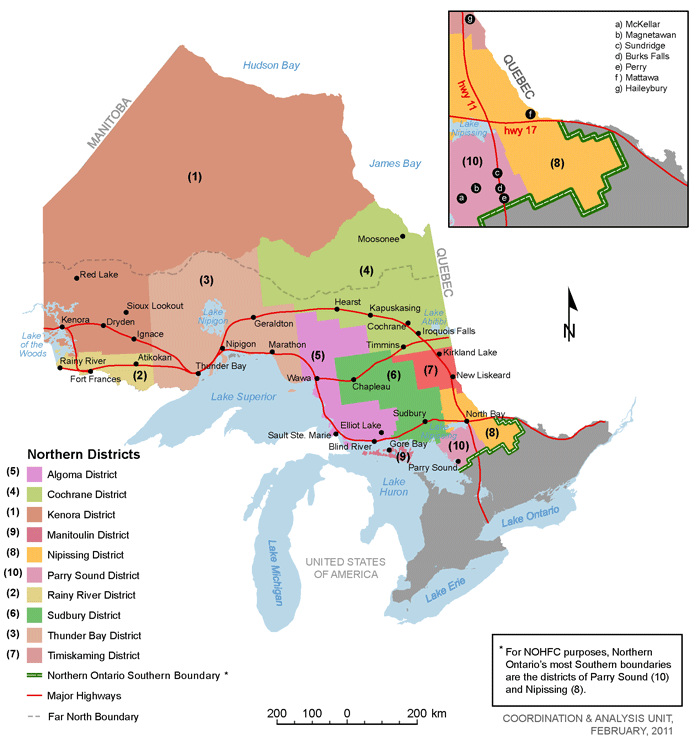
The Sudbury District is a district in Northeastern Ontario in the Canadian province of Ontario. It was created in 1894 from townships of eastern Algoma District and west Nipissing District. Included in the District are the following:
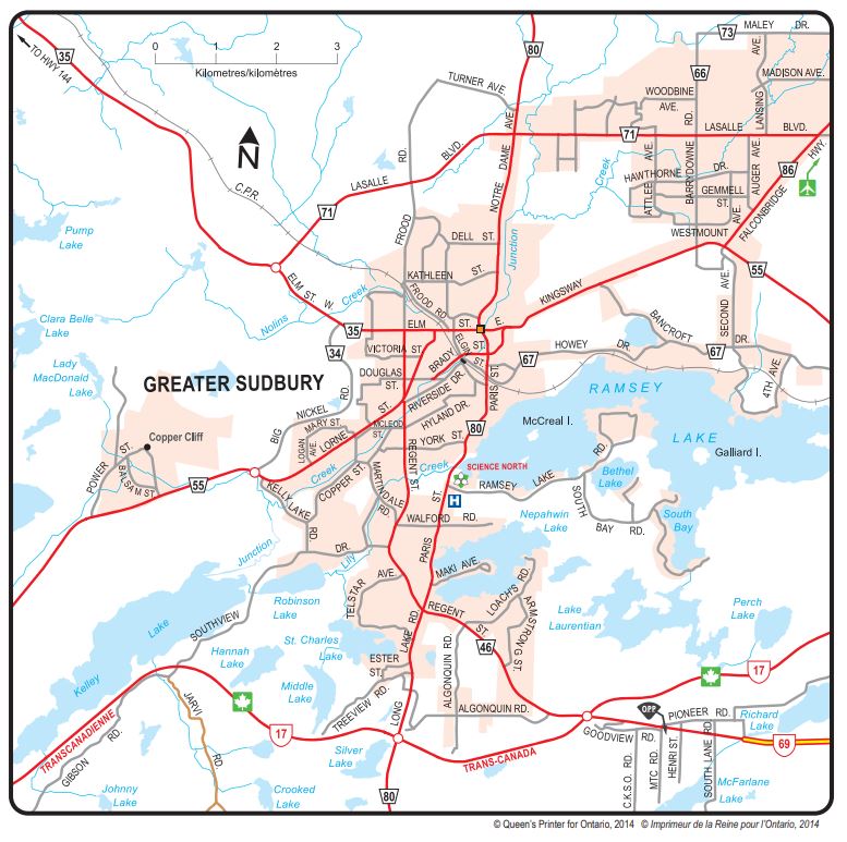
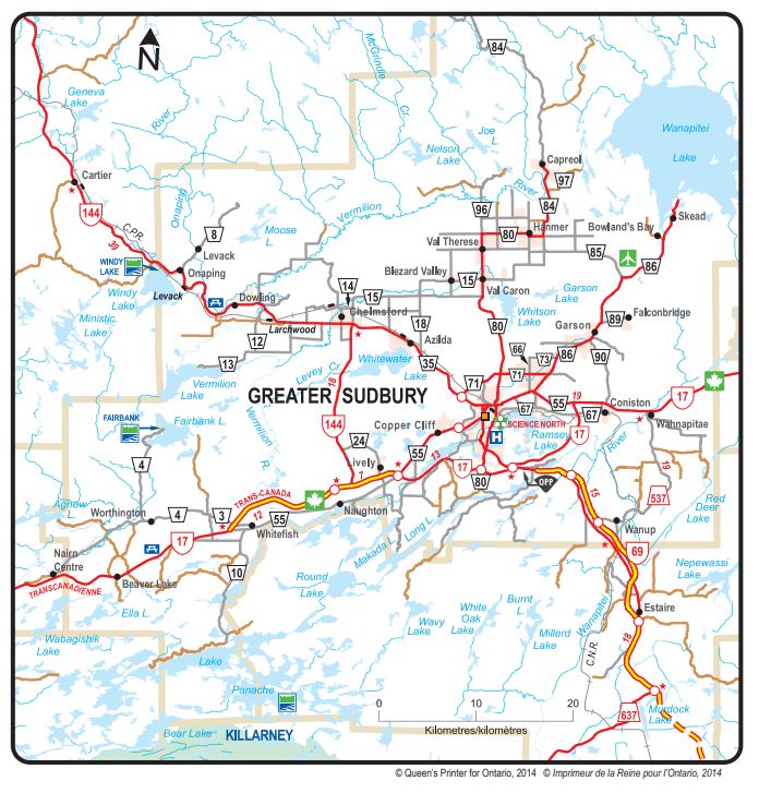
City of Greater Sudbury
Towns
Espanola
French River
Markstay-Warren
St. Charles
Townships
Sudbury District Townships
Townships within the City of Greater Sudbury
Unorganized areas
Sudbury, Unorganized, North Part
Communities
Benny
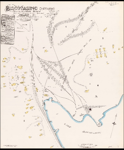
Biscotasing
Cartier
Estaire
Foleyet
Gogama
Mattagami
Metagama
Paget
Shining Tree
Sultan
West River
Westree
Whitefish Falls
Willisville
Ghost towns
Burwash
Creighton Mine
Jerome Mine
Kormak
Kukatush
Nemegos
Nicholson
Ramsey
First Nations Reserves
Chapleau 74A
Chapleau 75
Duck Lake
Mattagami
Mountbatten
Whitefish Lake
Whitefish River (boundaries include parts of both Sudbury and Manitoulin Districts)
City of Greater Sudbury Aerial Historical Photography
Sudbury District Cemeteries Map 2020
Many thanks to our Cemetery volunteers, Gary Peck (Coordinator) and Rochelle Dufresne True, who have identified the known cemeteries of the Sudbury District. Clicking on a locator bubble on the Google map will give the GPS coordinates at the gate of the cemetery.
We would like to point out that some cemeteries are on private property, while others can only be accessed by crossing private property. Please be respectful, and ask permission of the owners of the property before visiting.
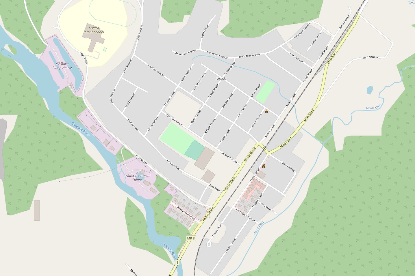
Miscellaneous Maps in the Sudbury District
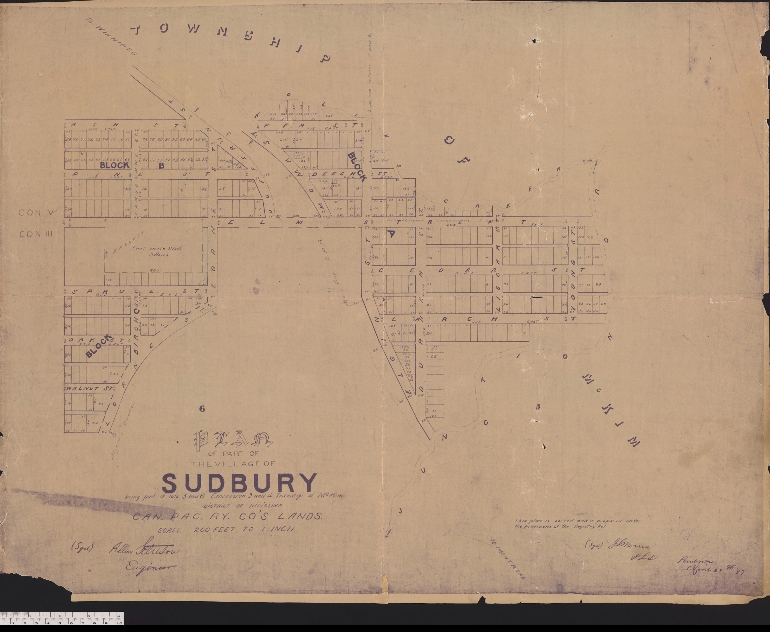
Street Map of ‘Little Italy’ Copper Cliff
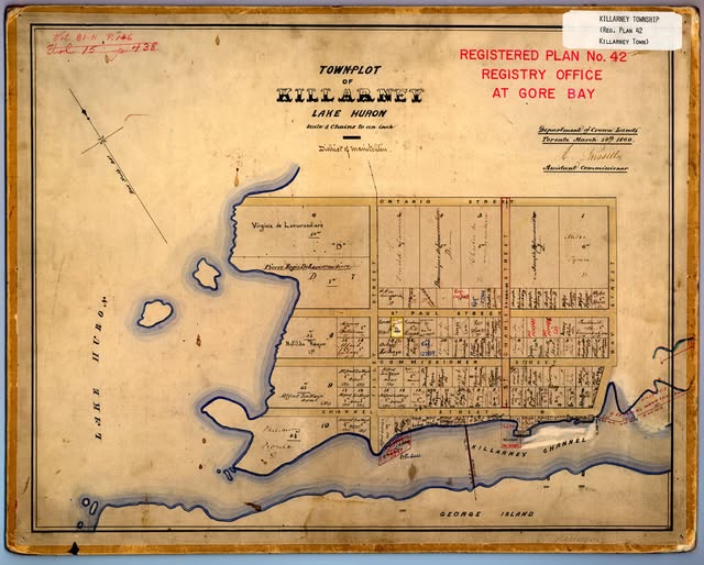
Street Map of the Village of Killarney Village of Killarney
Town of Creighton Mine 1961 Town of Creighton Mine 1950
Village List of O’Donnell, Village Plan of O’Donnell

